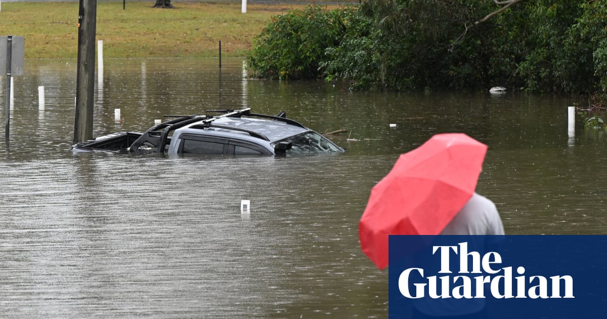
‘Unusually large’ multi-state storm causing severe weather for Australia’s east – with more on the way
0 / 24
English
中文
Large parts of eastern Australia were put on alert for severe thunderstorms on Sunday afternoon with more potential storms and flood risk in store for Monday.
(暂无翻译)
On Sunday afternoon, the Bureau of Meteorology issued a severe thunderstorm warning for Sydney, greater Wollongong and parts of Blue Mountains, Hawkesbury, Gosford, Wyong and Wollondilly, Wingecarribee areas.
(暂无翻译)
BoM said a broad line of storms had already swept through western New South Wales, while eight flood warnings were in place across southern Queensland after days of torrential rain.
(暂无翻译)
Severe thunderstorms that could bring hail, damaging winds, flash flooding and power outages were likely over a huge area on Sunday afternoon, the bureau said, including across southern Queensland, western NSW, the ACT and eastern Victoria.
(暂无翻译)
This article includes content provided by Facebook. We ask for your permission before anything is loaded, as they may be using cookies and other technologies. To view this content, click 'Allow and continue'.
(暂无翻译) (暂无翻译) (暂无翻译)
Wind gusts of up to 100km/h were recorded in the central west of NSW around midday on Sunday.
(暂无翻译)
“This is a multi-state system of storms and it’s unusually large,” said bureau meteorologist David Crock.
(暂无翻译)
Crock said an area of high pressure had been sitting over the Tasman Sea for the past 10 days that had been blocking weather fronts and bringing storms and rains to southern Queensland.
(暂无翻译)
“Eventually you get a strong enough system that pushes that blocking pattern away and that typically brings severe weather with it,” he said.
(暂无翻译)
A front of cooler air was moving from the west on Sunday afternoon, dragging in tropical moisture from the north and bringing storm conditions to central parts of NSW and to Canberra on Sunday afternoon.
(暂无翻译)
“We have a big line of storms that’s extending all the way from the Snowy mountains to the Queensland border. Behind that we are watching to see if there’s going to another band developing behind it.” Storm activity was likely to continue through Sunday evening and into Monday in northern NSW and southern Queensland as the cold front continued to push.
(暂无翻译) (暂无翻译)
“[Monday] is the last big bang of this system and that’s going to be a great relief for those people in south-east Queensland,” he said.
(暂无翻译)
Southern parts of Queensland had been through a weather “whiplash” in the past week, Crock said.
(暂无翻译)
Some eight flood warnings were in place over southern Queensland.
(暂无翻译)
The Mary River downstream of Gympie was forecast to reach major flood levels in Tiaro on Sunday evening and into Monday. After a very dry September, southern parts of the state had seen October rainfall “multiple times their average” for the month, Crock said, with areas around the Sunshine Coast seeing between 200mm and 400mm of rain in the past week.
(暂无翻译) (暂无翻译)
In the south-east, coastal showers are expected across Victoria and Tasmania, with snow falling above 800m above sea level in Tasmania.
(暂无翻译)
In Western Australia, cooler weather continues on Monday, with showers possible in parts of the south west.
(暂无翻译)
The bureau’s current long-range forecast for November to January suggests rainfall is likely to be above average over most of the country except the far north and much of Tasmania.
(暂无翻译)
November is likely to be warmer than usual for the southern half of the continent, with night-time temperatures in particular forecast to be likely well above average over most of the country.
(暂无翻译)
Global heating has seen Australia warm by about 1.5C since 1910, the bureau’s long-term climate data shows.
(暂无翻译)
仅供学习使用,如有侵权请联系删除 · 查看原文