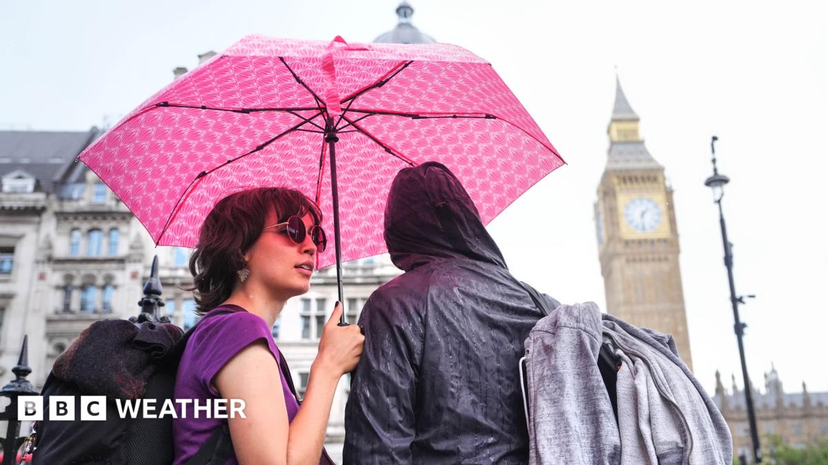
New thunderstorm warnings for parts of UK as rain set to continue
0 / 33
English
中文
The Met Office has issued fresh warnings for thunderstorms that will bring more wet weather to parts of the UK on Thursday.
气象局发布了新的雷暴警告,周四将为英国部分地区带来更多湿润天气。
The first warning is valid from 02:00 BST with thunder and heavy rain due to move across south-east England in the early hours of Thursday morning.
首次预警自英国夏令时02:00生效,周四凌晨将有雷雨横扫英格兰东南部。
A second comes into force at 06:00 BST for a wider area of England and Wales. This will last through to 22:00 and may become slow moving in the afternoon and evening.
第二条令将于英国夏令时间06:00生效,适用于英格兰和威尔士更广泛的地区。 这段时间将持续到22:00,下午和晚上可能会变得缓慢。
Downpours could bring localised flash flooding and travel disruption - with the wettest areas potentially seeing 75mm (3in) of rain. Large hail, lightning and gusty winds could accompany the showers and it will feel rather humid for many.
暴雨可能引发局部山洪和交通中断——最潮湿地区可能降雨量达75毫米(3英寸)。 大冰雹、闪电和阵风可能会伴随阵雨,对许多人来说会感到相当潮湿。
Spells of rain are set to continue over the weekend - a bank holiday for England, Wales and Northern Ireland - accompanied by windy conditions in the south.
周末期间,降雨将持续——英格兰、威尔士和北爱尔兰的银行假日——南部则将有风。
The Met Office issued new warnings for thunderstorms on Wednesday evening. Flooding and travel disruption are possible in the yellow warning areas Thursday morning will get off to a wet start in southern England and south Wales, with heavy downpours accompanied by lightning, hail and squally winds.
气象局于周三晚上发布了新的雷暴警告。 黄色警告区内可能出现洪水和交通中断 周四早晨,英格兰南部和南威尔士将以雨势开局,伴随着大雨、闪电、冰雹和阵风。
These will then move north across mid and north Wales, the Midlands and parts of eastern England, arriving in northern England during the early afternoon.
随后它们将向北穿越威尔士中部和北部、中部地区以及英格兰东部部分地区,于下午早些时候抵达英格兰北部。
As this initial line of downpours clears northwards the skies will brighten and sunny spells will develop, but further scattered showers that could again be very heavy and thundery are possible.
随着这条最初的降雨线向北消散,天空将变得明亮,会出现晴朗时段,但可能出现更多零星阵雨,可能再次非常强烈和雷鸣。
Some rain is likely to arrive in Northern Ireland and Scotland later in the day, although these northern areas of the UK are likely to avoid the very wettest weather.
北爱尔兰和苏格兰当天晚些时候可能会有降雨,尽管英国北部地区可能避免最潮湿的天气。
Why are there no thunderstorms showing on my app?
为什么我的应用里没有显示雷暴?
Within the Met Office yellow warning area, 20-30mm (0.8-1.2in) of rain could fall in just a few hours, with up to 50mm (2in) over a 12-hour period.
在气象局黄色警告区内,短短数小时内可能降雨量达20-30毫米(0.8-1.2英寸),12小时内可达50毫米(2英寸)。
Hills exposed to the easterly wind could possibly see 75mm (3in).
暴露于东风的山丘可能降雨75毫米(3英寸)。
Hazardous driving conditions are expected with a chance that roads will be closed and communities cut off.
预计将面临危险驾驶条件,道路可能封闭,社区被切断。
Lightning strikes could lead to power cuts, and hailstones of 1-2cm (0.4-0.8in) are also possible.
闪电可能导致停电,也可能出现1-2厘米(0.4-0.8英寸)的冰雹。
The wet weather will be welcome news for the large areas of England and Wales that remain in drought, however there is the increased risk of flash flooding where the ground is very dry and hard.
湿润天气对仍处于干旱中的英格兰和威尔士大片地区来说是个好消息,但地面干燥坚硬的地区也增加了突发洪水的风险。
Not enough rain will fall to alleviate the recent dry spell, with experts warning that months of persistent wet weather is needed to replenish water supplies.
降雨不足以缓解近期的干旱,专家警告称需要持续数月的湿润天气才能补充水源。
The coming weekend brings a number of festivals and high-profile events.
即将到来的周末将有多个节日和高规格活动。
Reading and Leeds Festivals both run from Thursday until Sunday, as does Creamfields in Cheshire.
雷丁节和利兹节都从周四持续到周日,柴郡的奶油田节也是如此。
Manchester Pride takes place from Friday until Bank Holiday Monday, while Saturday marks the start of Notting Hill Carnival in London, which also continues until Monday.
曼彻斯特骄傲节从周五开始,直到银行假期星期一,而周六则是伦敦诺丁山狂欢节的开始,狂欢节也持续到周一。
Festivalgoers at Reading will be hoping to avoid a repeat of these soggy scenes from 2024 The weather looks decidedly mixed for these events, with a fresher feel, brisk winds - especially in the south - and the likelihood of rain at times.
雷丁的音乐节观众希望避免重演2024年那种潮湿的场面 这些活动的天气看起来相当复杂,感觉更清新,风力清新——尤其是南部——有时还有降雨的可能性。
A zone of wet weather will move eastwards across England and Wales on Saturday, although drier and brighter conditions may spread from the west later.
周六,英格兰和威尔士将有一条湿润天气区向东移动,尽管稍后西部可能会有更干燥和更明亮的天气蔓延。
Northern Ireland and Scotland will be a little drier with some sunny spells, but there is still the chance of a few showers.
北爱尔兰和苏格兰将稍干燥,偶有晴天,但仍有几场阵雨的可能。
More heavy showers will move eastwards on Sunday, this time affecting most parts of the UK. Some of these could be heavy and thundery, with wind gusts touching 40-45mph (64-72km/h) in the far south-west of England later.
周日将有更多强降雨向东移动,这次影响英国大部分地区。 其中一些可能出现强烈雷声,英格兰西南部阵风可达40-45英里/小时(64-72公里/小时)。
Temperatures will tend to range from 16C (61F) in northern Scotland to 23C (73F) in southern England, which is about normal for late August. Low pressure remains in charge on Monday meaning strong winds and further showers, perhaps heaviest across the north of the UK.
气温通常在苏格兰北部的16摄氏度(61华氏度)到英格兰南部的23摄氏度(73华氏度)之间,这大致是八月底的正常水平。 周一低压依然主导,意味着强风和更多阵雨,可能是英国北部最为猛烈的。
There is no sign of a return to the dry and hot weather that has dominated this summer.
没有迹象表明会恢复到今年夏天主导的干燥炎热天气。
Whatever your plans for the weekend, you can keep up to date with the forecast by checking the BBC Weather website and app.
无论你周末有什么计划,都可以通过查看BBC天气网站和应用程序随时了解天气预报。
Stormy autumn, cold winter - how might El Niño affect the UK weather?
风雨交加的秋季,寒冷的冬天——厄尔尼诺现象会如何影响英国的天气?
Moon set to turn red as rare partial lunar eclipse graces UK skies How a new era of heatwaves could shake up the school calendar
随着罕见的偏月食,月亮将变成红色,点亮英国天空 新一波热浪如何可能搅乱学校日历
仅供学习使用,如有侵权请联系删除 · 查看原文