India news: National space agency ISRO to boost GPS alternative with new satellite launch
0 / 22
English
中文
The Indian national space agency's NVS-03 mission aims to strengthen NavIC, India's indigenous navigation system, and reduce reliance on the US-owned GPS. DW has more.
(暂无翻译) (暂无翻译)
Here are the top headlines from India on Friday, October 30: Tired of missing our real-time updates?
(暂无翻译)
Click here to add us as a Preferred Source on Google. Several districts in West Bengal, along with parts of Assam and Arunachal Pradesh, were placed on flood alert on Friday, media reports said.
(暂无翻译) (暂无翻译)
The flood, triggered by a glacial lake burst at Sintaphu Lake in neighboring Bhutan, swept away infrastructure at the Gasa Tshachu natural hot springs in the Himalayan kingdom.
(暂无翻译)
Indian authorities have stepped up monitoring along the Sankosh River, which flows from Bhutan through West Bengal and into Assam.
(暂无翻译)
Communities along the Brahmaputra River in Assam and Arunachal Pradesh have also been alerted over possible flooding. In Bhutan, no casualties have been reported, state broadcaster BBS said.
(暂无翻译) (暂无翻译)
According to Bhutanese media reports, two Bailey bridges, built in portable, pre-fabricated sections, may have been washed away, as well as a part of the road leading to Laya village, where the hot springs are located, had also been washed away.
(暂无翻译)
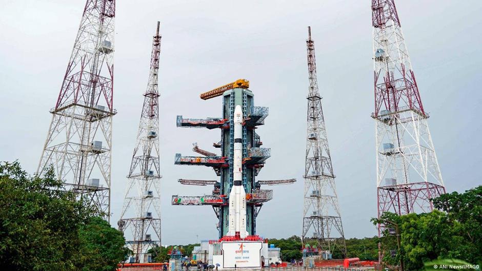
India's space agency is set to launch a navigation satellite on Friday night to strengthen the country's indigenous alternative to GPS.
(暂无翻译)
According to Indian Space Research Organisation (ISRO) the NVS-03 is "intended to augment the NavIC constellation and support continuity of navigation services."
(暂无翻译)
The NVS-03 satellite, the third in ISRO's next-generation navigation series, will be carried into orbit by the GSLV-F18 rocket from the Satish Dhawan Space Centre in Sriharikota at 11:51 p.m. (1821 GMT) on Friday.
(暂无翻译)
According to ISRO, the satellite features an indigenous atomic clock alongside imported clocks, and adds the L1 signal to the existing L5 and S-band signals.
(暂无翻译)
It is designed to provide navigation coverage across India and up to 1,500 kilometers (932 miles) beyond its borders. NavIC is seen as an alternative to the Global Positioning System (GPS) system owned by the United States government.
(暂无翻译) (暂无翻译)
It was developed to reduce India's dependence on foreign navigation systems, however, according to the Hindustan Times newspaper, the program has faced repeated setbacks, including failing atomic clocks and satellite launch and deployment problems.
(暂无翻译)
Last month, India had launched of its EOS-05 Earth observation satellite, its first ever imaging satellite in geosynchronous orbit. Hello!
(暂无翻译)
This is Shakeel from DW's New Delhi Studio bringing you the top updates from across India.
(暂无翻译)
All eyes will be on the skies today as India prepares to launch a navigation satellite to strengthen its indigenous alternative to GPS, reducing the country's reliance on the US government-owned system. Meanwhile, the results of the Legislative Council elections in the northern Indian state of Uttar Pradesh serve as a warning from the Samajwadi Party to the ruling Bharatiya Janata Party (BJP) ahead of the 2027 state elections.
(暂无翻译) (暂无翻译)
Elsewhere, the states of Assam and West Bengal are on flood alert after a glacier burst in Bhutan.
(暂无翻译)
仅供学习使用,如有侵权请联系删除 · 查看原文